Page 1 of 1
Best way to get to Sag Harbor?
Posted: May 19th, '07, 10:42
by IRGuy
For you Long Island boaters. A friend has to deliver a boat to Sag Harbor next week.. from here in NC. Is it best to stay out and enter LI Sound from the east, or go up through New Your City and enter the Sound from the west?
Posted: May 19th, '07, 11:00
by Harv
Depending on the size of the boat, he can enter Shinnecock inlet from the South Shore, travel through the canal into Peconic Bay and proceed from there. This route would probably be the shortest route mileage wise. I'm sure the Professor could give more information about taking this route.
Posted: May 19th, '07, 11:10
by IRGuy
Thanks Harv..
I will find out what size boat they will be in and post that info here.
Frank
Posted: May 19th, '07, 12:22
by mike ohlstein
Get draft, tower height and ease of lowering antenna info too........
A good GPS will be helpful in the bay.
Posted: May 19th, '07, 14:13
by Capt Dick Dean
Taking a straight shot from SC to the Shinnecock Inlet is by far the shortest way. Be aware that you must transverse the Shinnecock canal and the current can get to seven kts. That's if you don't want to go around Montauk Pt. Going thru the Canal, the boats get in single file because it's tight. Going with the tide you must make way better than the tide to gain steerage. Tenga cuidado!
And the clearence under the bridge is 22 feet at high tide. Nobody knows when high tide is, it's that much of a mystery.
How can that be?
Well, the distance from the ocean to the south side of the canal is 3.5 nm. Now from the north side of the canal to the south side of Shelter Is is 5 nm; from the north side of Shelter Is is 6.5 nm. The high tide gets to the Canal both from the north and the south. The Mason-Dixon line dosen't come into play and is not revelant. That Line is way South. But there is slack water when the tide from the south is as high as the water at the north side. Right?
Are we clear so far? I mean when is it high tide at the Shinnecock Inlet in relation to high tide at Orient Pt and then at Shelter Is ? You understand that the tide has to past these points in order to get to the Canal! On any given day you can look it up. But then go figure the tide at the canal. I know one thing -- the tide is going south though the Canal when the water is starting to come into Shinnecock Bay. And you can tell slack water -- that's when the sailboats go thru.
Oh,yeah! The Canal is closed at certain times during the tide changes. And then you wait.
I think I remember reading a tide chart for the Canal and it went like this. On that day it read: SEE THE TIME FOR JONES INLET, ADD THREE HOURS DURING THE WINTER MONTHS ON TUESDAY AND FRIDAY ONLY. IF DAYLIGHT SAVING TIME IS IN EFFECT, DON"T PASS IN EITHER DIRECTION AFTER 3:00PM IF THE MONTH ENDS IN R. ALWAYS WEAR SEATBELTS.
Posted: May 19th, '07, 15:49
by CaptPatrick
Frank,
By the time you dick around with tides & bridges, skipping through bays and around Shelter Island to get to Sag, you'll have gone just about the same number of miles as if you just went ahead and kept the throttles down and round Montauk point, north over Gardners Island and come in on Sag through Gardners Bay.
I'd bet that since you can stay at cruise speeds longer staying off shore to Montauk and still maintaining that speed through most of the sound to Gardners, you'll possibly have less hours than "short cutting" through an inlet and canal system that requires allot of first hand local knowledge.
Would be fine if you had Mike O as your on board pilot, but short of that, (& if were me on my first run to Sag), I'd stay deep as long as possible. You've got no small inlet, currents, congestion, or other annoyances by going around the point...
My 2¢ worth...
Br,
Patrick
Posted: May 19th, '07, 16:17
by In Memory Walter K
Alternate scenic route-Through NY Harbor, Hell's gate under the Triboro, Whitestone and Throggs Neck Bridge-up LI Sound's North Fork. Through The Race, pass Shelter Island to Sag. No matter which way you go, stay within the bouys when you approach Sag Harbor. Huge rocks just a few feet under water in the middle of nowhere. If you come via Montauk, pass Gardner's Island to the right of the "Ruins" bouy. It looks like there's plenty of water between the bouy and the actual Ruins off the island, but stay on the outside. Walter
Posted: May 19th, '07, 16:43
by Harv
One other thing to consider is fuel consumption. No matter which route you plan to take, either through NY Harbor to the sound, around the point, or through the canal, you may very well have to put in somewhere in the area for fuel. I suggested the canal route because you could save miles instead of hugging the coast into the harbor. It is very possible that your fuel requirements may actually dictate which route you take. Almost any inlet on the south shore of Long Island will have fuel docks. In NY Harbor, you can pull into Liberty Landing on the Jersey side of the Hudson by the Big Clock on your port side. From there you can shoot around the south side of Manhattan up the East river through Hell's Gate into the sound. Debs, Jones, Fire Island, and Shinnecock inlets all have fuel docks in their vicinities.
Posted: May 19th, '07, 16:44
by Terry Frank
I lived on Long Island most of my life and regret that only once I made the trip from the Long Island Sound down past the city. It was an awesome experience. We docked over in NJ and later anchored up by Governor's Island to watch the Macy's 4th of July fireworks. If you've got the time go into NY Harbor and up the East River. Bring a camera.
Posted: May 19th, '07, 18:34
by CaptPatrick
Terry,
You're right! That's the trip I've made three times, always coming from, going to the north shore of LI, one trip down from Stanford, CT. The Sound & through Manhatten is a hoot. Bruce made two of those trips with me and another with someonr else.
Always have strange visions passing Execution Rock. They realy knew how to despense justice in the old days...
Br,
Patrick
Posted: May 19th, '07, 18:54
by IRGuy
Thanks guys! Looks like my friend has some decisions to make! Still haven't seen him since this AM before I posted my first msg so I don't have the boat info yet.
BTW, Capt. Pat.. many years ago I worked for Con Ed in New York City and lived on a boat on City Island. Execution Rock was visible from the marina. Most people think they hung people there.. but the locals said no, they took the bad guy and buried him feet down with his head sticking out of the sand facing seaward between the high and low water marks. If they were interested they came back the next day to see how he was doing.
Posted: May 19th, '07, 19:23
by IRGuy
Just spoke with my friend who is already heading north.. the following info might eliminate the Shinnecock Inlet route..
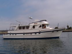
Not sure what boat he is in, but he learned today before they left NC that they would be traveling with a 72' trawler as company.. which probably draws 6' and has a 18-20' beam. Height is probably +/- 22' with antennas down!
Sounds as if they will have to pass on the inlet and go through NYC or take the route around LI. From the scary things you guys are saying it sounds like the canal is impossible.
Posted: May 19th, '07, 20:11
by CaptPatrick
Frank,
With Trawler(s) involved, round Sandy Hook into the NY Harbor and take the scenic route through Manhattan. My one trip from Stanford to West Palm Beach was delivering a 60 ft Defever motoryacht.
Talk about a slow boat to china... 7 knots, all offshore once we pulled out of NY Harbor, 24 hours a day for 5 days. Was just after "The Perfect Storm", 8' - 10' following sea all the way to offshore Georgia. Gag...
My other two trips were on a 56' Hatterass MY, damnrd as bad, but at least Bruce was along to keep me from going stir crazy. We both "officially" quit delivering boats aft the Hatt.
Knew about the drowning detail, that's what makes it a neat place. Imagining the look of terror in the convict's eyes as the tide came in... Hellova' sentence.
Br,
Patrick
Posted: May 19th, '07, 20:34
by randall
if it was me id head for montauk..go north of gardners and into sag....................I CAN NOT STRESS ENOUGH HOW IMPORTANT IT IS TO STAY IN THE CHANNEL APPROCHING SAG HARBOR.....its a little counter intuative as the channel is way on the south side and you will see locals cutting close to the south shore of shelter island.......all the water in between is full of rocks and the rocks south of the channel are dry at low tide..............i've been on two boats that have hit rocks and they were both run by locals
Posted: May 21st, '07, 09:34
by IRGuy
To all of you here who offered suggestions...
I just spoke with my friend a few minutes ago.. he says they will go into Sandy Hook tonight and up the Hudson and then go east into LI Sound tomorrow. With a 72' trawler moving with them they don't think the Shinnecock Inlet and canal route will work.
FYI: I have another friend who arrived on Cape Cod from Norfolk yesterday, and he said there were large rollers with some big breakers off shore that beat them up pretty bad in their 46' cruiser. My friend going to Sag Harbor says that today they are getting banged up as well.. the 72' trawler is leading the way, with them in their 44' following. He says that without the trawler leading the way they probably would be in trouble.
Thanks to you all for your help! I copied and pasted all your comments into an email and sent them to him yesterday, and he is very appreciative. He is still trying to decipher Dick Dean's summary, but that is not such an issue now!
You guys are great!